DJI has announced updates to its geofencing system (GEO) that applies to most of its consumer and enterprise drones in the United States. The changes took effect on January 13th on the DJI Fly and DJI Pilot flight apps.
The update is similar to changes implemented in the European Union in 2024.
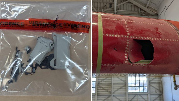
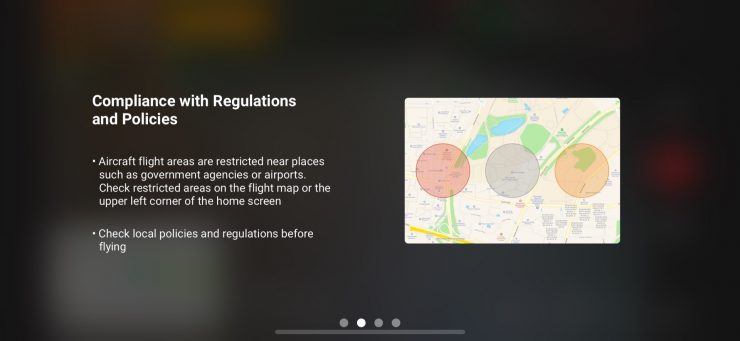
With the recent incident of a lightweight DJI consumer drone being struck by a water-dropping “Super Scooper” aircraft in the Los Angeles Wildfires, it is a surprise that DJI decided to make flying in restricted zones unlawfully easier. When I say restricted zones, I mean military bases, airports, and even over the White House in DC. While you can take off and fly in restricted areas now, they are still restricted and not allowed. As a pilot, you will be held responsible to the fullest extent of the law.

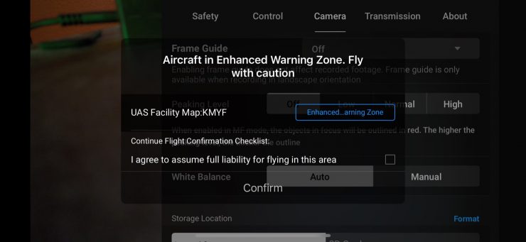
After updating the DJI Fly and Pilot flight app, operators will see prior DJI geofencing datasets replaced with official Federal Aviation Administration (FAA) data. Areas previously defined as Restricted Zones or No-Fly Zones will be displayed as Enhanced Warning Zones. This aligns with the FAA’s designated areas. In these zones, in-app alerts will notify the operator flying near FAA-designated controlled airspace, placing control back to the drone operators, in line with regulatory principles of the operator bearing final responsibility.
DJI introduced the GEO system in 2013 when consumer drones were still a new technology, and formal drone flight rules and regulations were thin. The Geofencing System was created as a voluntary built-in safety feature to help with responsible flight practices and prevent DJI drone operators from unintentionally flying in restricted airspace, such as around government buildings, airports, or prisons.
This GEO update has been active in the UK and several EU countries since January 2024, starting with European countries that have implemented geographical maps compliant with existing technical standards, such as Belgium, Germany, and France. In June, it expanded to Estonia, Finland, and Luxembourg. The remaining EU countries under EASA jurisdiction will also receive the update this month.
DJI reminds pilots always to ensure flights are conducted safely and in accordance with all local laws and regulations. For flights conducted in Enhanced Warning Zones, drone operators must obtain airspace authorization directly from the FAA and consult the FAA’s No Drone Zone resource for further information.
DJI states “The GEO system has always been an educational – not an enforcement – tool. The GEO system has also not been removed; warning zones and in-app alerts remain in place to continue educating pilots on safe flight operations. This change gives back control to operators and provides them the information they need to fly safely.”
DJI
DJI remains committed to promoting safe and responsible flight practices and will continue its community education efforts, reminding pilots to always ensure their flights are conducted safely and in accordance with all local laws and regulations.
While I like being able to fly more freely in my area that is surrounded by restricted areas, I do worry about people using DJI drones irresponsibly and causing incidents that could harm individuals or property. Time will tell, and I see the FAA changing the laws that will implement the Geofencing feature in all drones.
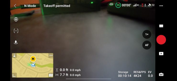
For manned aircraft, the Federal Aviation Regulations specify a minimum safe altitude of 1,000 feet over congested areas and 500 feet over non-congested areas. Under normal circumstances and in most countries, consumer drones are not allowed to fly above 400 feet from ground level. The new feature comes in handy when you want to fly well below 400 feet in restricted areas, such as low follow shots.
What are your thoughts on this new development from DJI?